Station-edge, slope and foreshore project planning

Building, Civil and Remedial Project Planning in Waverton NSW

SCE Corp reviews suitable Waverton enquiries where proposed work meets mixed-use occupancy, railway or street access, sloping ground, sandstone, foreshore conditions or former industrial fabric.

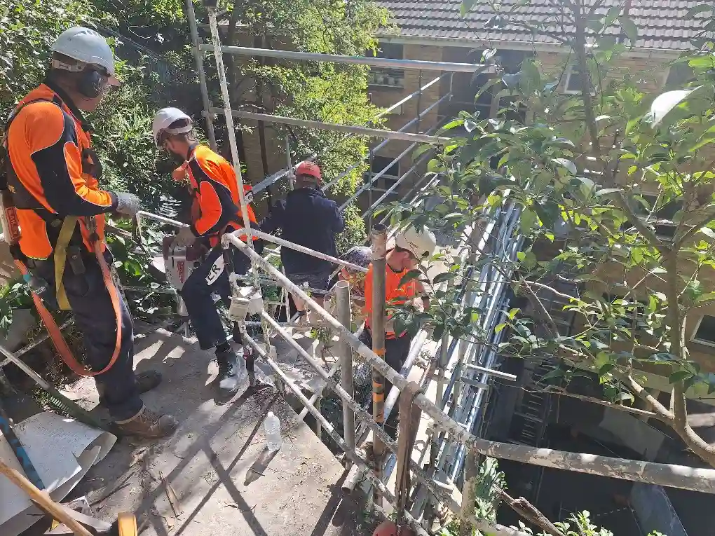
Workers using scaffold access and fall protection during controlled footbridge demolition at Lane Cove North
Controlled SCE Corp footbridge demolition at Lane Cove North, shown as regional access and sequencing evidence rather than Waverton project proof.

Map the Waverton context before selecting a service pathway

North Sydney Council's current Waverton/Wollstonecraft planning-area guidance separates the locality into several distinct settings. Bay Road's village centre is mixed commercial-residential beside the railway station. The village neighbourhood contains long, narrow residential lots, steep falls and tall sandstone retaining walls. The wider neighbourhood and peninsula include ridge roads, bushland, former industrial landmarks, maritime interfaces and steep foreshore terrain.

Those differences affect far more than wording on a location page. A useful construction brief should identify the site's terrain, frontage, neighbouring uses, public interface, previous land use, drainage route and the professional information needed to define a safe work package.

Use the North Sydney DCP 2025 Waverton/Wollstonecraft planning-area guidance as current context, then confirm the property-specific controls with the relevant advisers and authority.

Three Waverton settings create different construction questions

Bay Road village and station edge

Boundary-built frontages, continuous awnings, shops, upper-level accommodation, the railway cutting and pedestrian movement can converge within a short work zone.

  • Trading and resident access
  • Awning, shopfront and threshold protection
  • Rail-interface or emergency-access constraints
  • Short-duration deliveries and waste removal

Village slopes and retaining fabric

Long, narrow lots plus steep changes between streets can place garages, rear yards, subfloors, retaining walls and drainage at different levels.

  • Surveyed levels and wall geometry
  • Sandstone, masonry, joints and coping
  • Surface water, subsoil drainage and outlets
  • Neighbour access and temporary support

Peninsula and foreshore interface

Balls Head, Berrys Bay, former gasworks or oil infrastructure, maritime areas and remnant shoreline context require precise property evidence rather than suburb-wide assumptions.

  • Foreshore or public-access boundaries
  • Bushland, erosion and sediment controls
  • Historic-use records and specialist advice
  • Cliff, tank-cutting or maritime interfaces

Choose the pathway that matches the physical interface

A Waverton address may require one service stream or a coordinated package. The observed condition, asset type and required outcome should decide the route.

Civil and site-interface works

For defined external works, access, retaining, drainage, concrete, demolition or temporary-work interfaces supported by appropriate design and approvals.

Explore Civil Services

Building-fabric remediation

For evidence-led repair scopes involving water entry, façades, roofs, balconies, masonry, concrete or structural deterioration.

Explore Building Remedial Services

Mixed-use refurbishment

For occupied retail, commercial or residential premises needing staged upgrades, protected circulation, services coordination and controlled handback.

Explore Commercial & Industrial Services

Treat terrain and previous use as evidence questions

Slopes, cuttings and retained ground

Photograph the high side, low side, wall ends, joints, outlets and surfaces above the affected area. Note bulging, open joints, erosion, staining, salt, displaced coping, recurring ponding or movement. A repair decision may need structural, drainage, geotechnical or waterproofing input before a builder can price a durable package.

Temporary access deserves equal attention. Scaffold bases, excavation, spoil handling, delivery points and protection must suit the real level changes without loading unverified structures or blocking an essential route.

Former industrial or maritime context

The planning document identifies former gasworks, oil-industry and maritime landmarks within parts of Waverton. That history does not prove a condition at a particular property. It does mean the briefing team should check reliable site records before assuming ordinary excavation, disposal, coating removal or ground-contact work.

Where investigation is required, define who samples, classifies, designs, approves and signs off the response. Construction sequencing should follow verified specialist advice rather than use the suburb's history as a substitute for evidence.

Plan constrained access before pricing production

Public edge

Pedestrian path, shop entry, station route, awning, kerb, road occupancy, signage and after-hours security.

Vertical movement

Stairs, hoists, scaffold, material lifts, narrow side passages, fall protection, carry distances and emergency egress.

Ground disturbance

Service locating, excavation limits, shoring, spoil classification, stockpile protection, runoff and clean-down.

Occupied asset

Resident notices, tenant trading, noisy work windows, dust isolation, temporary services, daily clean-down and staged return.

Foreshore sensitivity

Sediment capture, material storage, weather response, public access, vegetation protection and controlled discharge.

Closeout package

Inspection points, test results, concealed-work photographs, approvals, warranties, as-built records and maintenance advice.

Responsibility boundary: SCE Corp coordinates construction for an agreed scope. Rail, environmental, heritage, engineering, design, certification and registered-practitioner duties remain with the correctly appointed parties. SCE is NSW DBP registered.

Regional project evidence, clearly labelled

SCE Corp does not represent the Lane Cove examples on this page as Waverton projects. They demonstrate relevant North Shore delivery capability around controlled access, demolition and structural remediation. Every Waverton enquiry still requires an address-specific review.

Review the Lane Cove structural remedial project, then use the Remedial Planning Tool to organise the initial defect and site information.

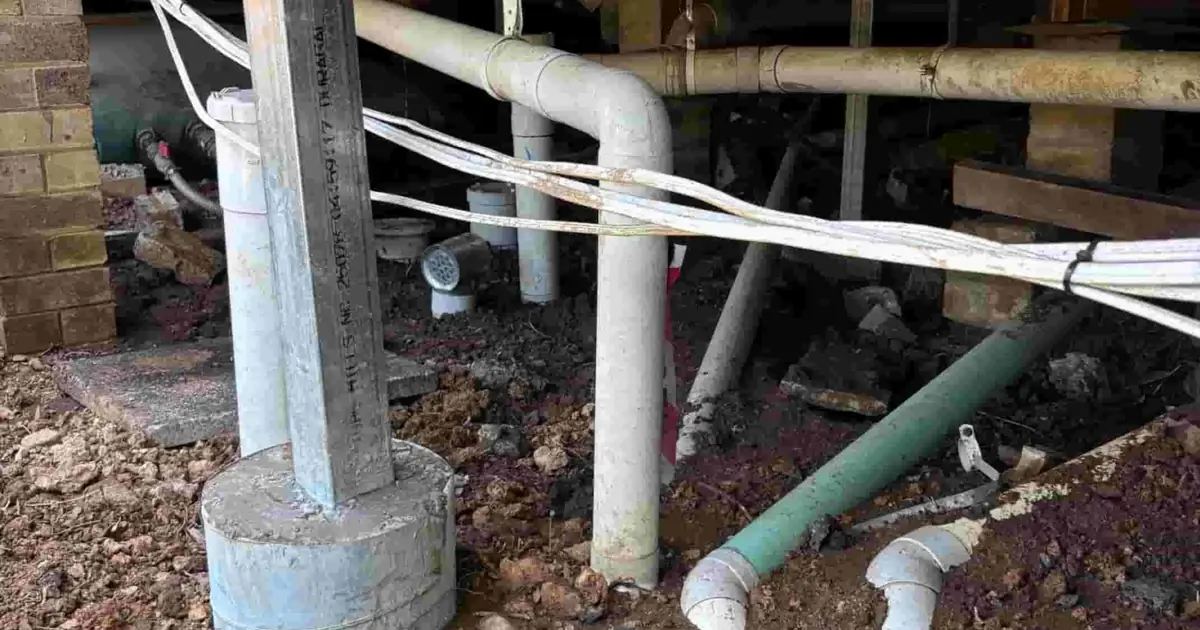
Completed structural steel and footing repairs on an SCE Corp remedial project in Lane Cove, NSW
Completed Lane Cove structural remedial work, presented as North Shore capability evidence rather than a Waverton project.

Send a Waverton evidence pack that can be assessed

Property and condition record

  • Exact address, lot access and current use
  • Wide-context plus close-detail photographs
  • Survey, drawings, reports and earlier repair history
  • Ground levels, drainage, retaining or foreshore information

Delivery and authority record

  • Occupants, trading hours and essential routes
  • Rail, road, public-domain or environmental interfaces
  • Known approvals, consultant roles and decision-makers
  • Desired timing, staging and handover evidence

Waverton project questions

Answers for owners, strata managers, businesses and asset teams preparing a building, civil-interface or remedial enquiry.

Why should a Waverton enquiry identify the exact precinct?

North Sydney Council's current planning guidance distinguishes the village centre, village neighbourhood, wider Waverton neighbourhood, peninsula and other locality areas. Each carries different built-form, access, landscape and heritage considerations, so the address must be checked before a construction pathway is assumed.

Can SCE review work near Waverton Station or Bay Road businesses?

SCE can review a defined building, refurbishment or remedial package where station-edge access, a public footpath, trading activity, residents or shared services affect delivery. The project-specific brief must establish approvals, work zones, protection and operating constraints.

What information helps assess a sloping Waverton property?

Provide a survey or available levels, retaining-wall details, drainage information, photographs from above and below the affected area, visible cracking or dampness, access routes and any structural, geotechnical or waterproofing advice.

Does former industrial use automatically mean a Waverton site is contaminated?

No. Historic land use is a prompt to review reliable property-specific records, not proof of contamination. Any required environmental assessment, sampling, design or remediation advice must come from suitably qualified specialists for the exact site.

Are the Lane Cove images evidence of completed Waverton work?

No. They show verified SCE Corp projects in Lane Cove and Lane Cove North. They are labelled as North Shore capability evidence only, not as Waverton project proof.

What should be included in a Waverton building or civil-interface enquiry?

Send the exact address, scope objective, photographs, drawings or reports, occupancy information, ground and drainage context, rail or foreshore interfaces where relevant, access constraints, desired timing and the authorised decision-maker.

Discuss a Waverton building or site-interface scope

Send the address, project objective, photographs, drawings, reports and access constraints so SCE Corp can assess service fit and the next practical step.