Roof, balcony and wall interfaces
Record when moisture appears and inspect junctions, flashings, penetrations, membranes, falls and discharge points. A repair should address the proven route, not only the visible stain.

Bushland-edge, water-pathway and site-access planning
SCE Corp delivers building, remedial and civil construction in Chatswood West, coordinating structural repairs, water-ingress rectification and drainage interfaces. We bring construction methodology, terrain, access and temporary protection together for complex sites, including properties near Blue Gum Creek and the Lane Cove bushland.
Chatswood West includes established residential streets and areas connected to Blue Gum Creek and the Lane Cove National Park landscape. Willoughby City Council’s Chatswood West route information identifies Blue Gum Creek and the national park as part of the local setting. That context is useful, but it does not prove that every property has the same slope, vegetation, drainage or hazard constraints.
The practical first step is an address-specific review. Existing fabric, ground levels, surface and roof-water paths, nearby trees, retaining elements, access for people and materials, occupancy and available records can change the appropriate investigation and construction sequence.
A damp internal finish, eroded garden edge or movement at an external element may be a symptom rather than the source. The review should follow the pathway before a repair method is selected.
Record when moisture appears and inspect junctions, flashings, penetrations, membranes, falls and discharge points. A repair should address the proven route, not only the visible stain.
Confirm how paved areas, roofwater, pits, pipes and overland flow interact with the building and boundary. For properties within Willoughby, the council’s stormwater, flooding and on-site detention guidance points applicants to current controls for water quality, detention, flood-controlled lots and erosion or sediment measures.
Changes in level, retaining walls, tree protection areas and constrained side access can affect investigation, temporary protection, excavation, spoil movement and reinstatement. The exact site condition determines what specialist input is required.
Trace the physical clues: Map downpipes, grated drains, retaining-wall outlets, seepage points and the downhill escape route. Photograph ponding, sediment trails, moss bands, efflorescence, washed joints and cracked finishes. Note whether runoff crosses paving, garden beds or neighbouring land before reaching a lawful discharge point. These observations help the appointed team distinguish blocked assets, insufficient falls, failed waterproofing, groundwater and exceptional storm events.
The Council route confirms a local creek and bushland setting. It does not replace a survey, drainage investigation or property-specific assessment. Use it as a prompt to collect better field evidence.
Leaf staining, silt deposits, gutter overflow marks, damp retaining joints and scoured garden edges can reveal direction and duration. Photograph these traces before cleaning or demolition removes them.
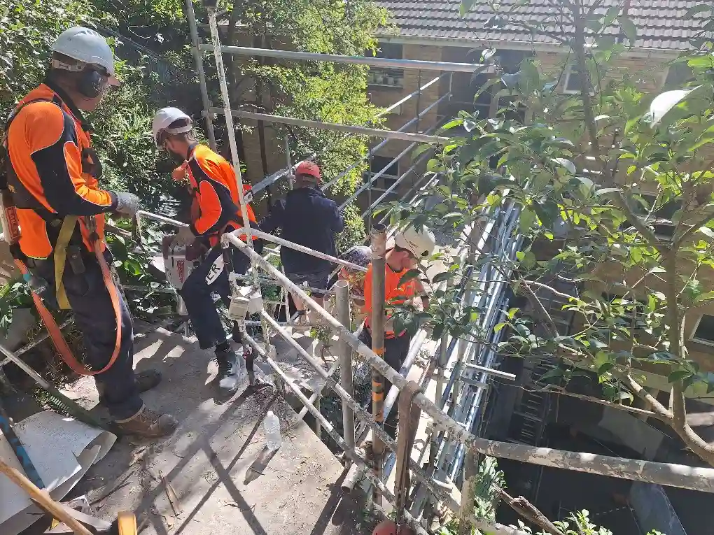
Tree trunks, overhanging branches and visible roots can influence scaffold positions, excavation limits and the route for carrying materials. Any pruning or arboricultural conclusion must follow the current authority process and specialist advice.
Where disturbed ground is unavoidable, nominate covered stockpiles, inlet protection, stabilised access and end-of-day checks before mobilisation. The required erosion and sediment controls depend on the actual disturbance, gradient and forecast conditions.
SCE investigates the construction interfaces and delivers repairs for water ingress, deterioration, cracking and damaged building elements. Our Building Remedial Services cover the repair methodology and coordinated reinstatement.
Where the property remains occupied, the plan should also address access zones, dust and noise controls, temporary weather protection, safe separation and staged reinstatement.
External drainage, pavement, retaining, excavation and access works can be integral to resolving a building defect. SCE’s Civil Services bring these packages into the construction sequence, with the required design and site controls established before work proceeds.
Any design, certification, flood, structural, geotechnical, arboricultural or regulated-practitioner responsibility remains with the appropriately qualified and appointed professional.
Chatswood West is shared between Ryde and Willoughby, as confirmed in the City of Ryde suburb profile. Confirm the council for the exact address, then check the applicable planning controls, current certificates and property maps. A suburb name alone does not establish the relevant council or approval pathway.
A sloping or bushland-edge site may need a delivery plan for stairs, narrow side passages, scaffold bearing, temporary drainage, pump or hoist locations, spoil removal and protection of adjoining surfaces. Establishing these logistics before mobilisation reduces improvisation once the work area is open.
Wet-weather hold points, temporary covers, sediment barriers and a clear end-of-shift make-safe routine can be built into the method where the actual site requires them.
Responsibility line: SCE Corp manages construction delivery and coordinates with the consultants, designers, certifiers and registered practitioners required for the project. SCE is NSW DBP registered. The appointment and scope of each regulated or specialist role must be confirmed for the actual work.
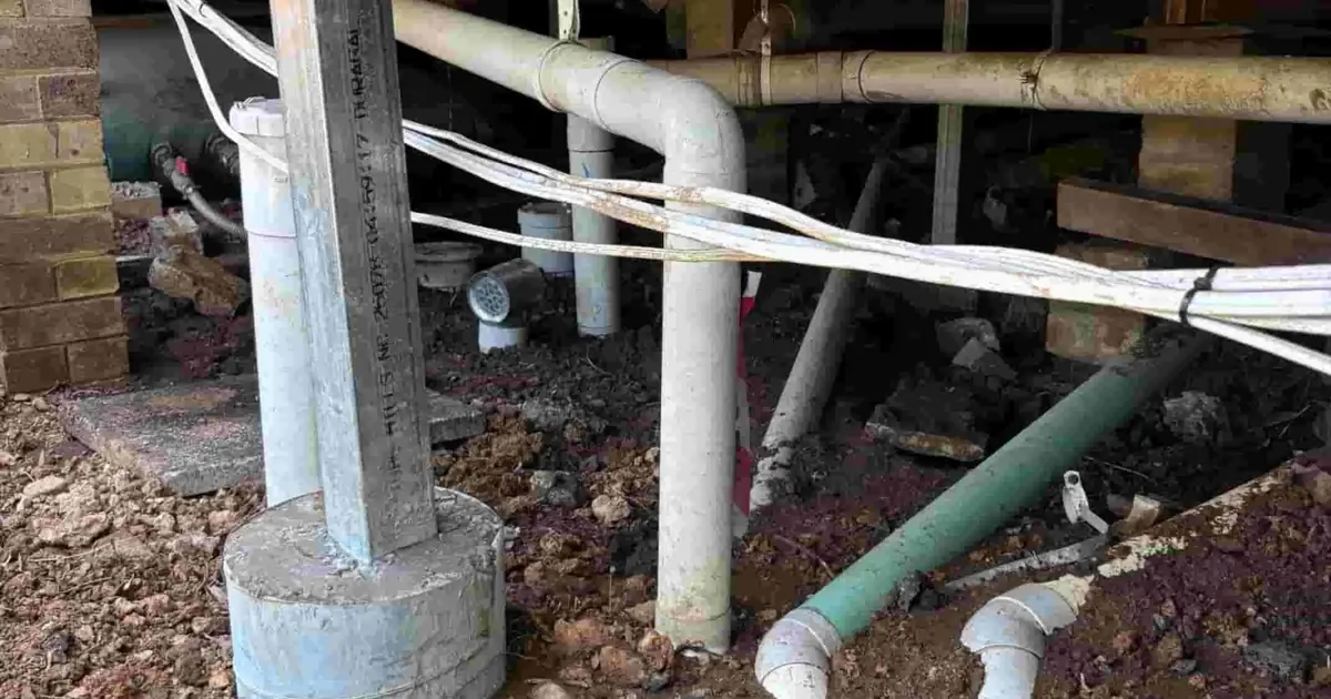
At SCE’s Lane Cove structural remedial project, temporary support, engineered footing and steel work, broken sewer replacement and reinstatement were coordinated around a school programme. It demonstrates why the sequence must account for both the structure and concealed services before finishes close the work. This completed project is in Lane Cove. The Remedial Planning Tool can help organise the initial defect and site information before an enquiry.
Address-specific answers for planning a Chatswood West building or remedial enquiry.
Chatswood West properties do not share one set of conditions. The address helps identify the relevant planning controls, slope, drainage paths, bushland or waterway interfaces, access limits and any records that should be reviewed before the construction scope is settled.
No. These constraints are site-specific. Current maps, certificates and authority information should be checked for the exact property rather than assuming that a condition affecting one part of Chatswood West applies to the whole suburb.
Useful evidence can include photographs after rain, the location and timing of dampness, roof or balcony details, stormwater information, previous reports, drainage layouts and any history of repair. This helps separate symptoms from the pathway that may be causing them.
Yes. SCE delivers and manages building, remedial and civil construction packages together, including their sequencing, temporary works and reinstatement interfaces. Consultants, designers, certifiers and registered practitioners retain the professional responsibilities defined by their appointments.
Access width and gradient, material handling, scaffold or temporary support, spoil removal, weather protection and reinstatement can materially affect the construction price. The proposal should distinguish confirmed work from investigation-dependent items and identify how concealed conditions will be assessed before additional work is authorised.
Provide the exact address, property and occupancy type, a concise description of the issue or proposed work, photographs, available drawings or reports, known drainage or access constraints, desired timing and the authorised decision-maker.
Share the address, proposed works, reports and access constraints. SCE will review the construction approach, investigation needs and staging required to prepare a defined project scope.