Property and workface
Identify the house, apartment, common property or other asset; the room, elevation, roof, yard or external area involved; and whether the workface is above, below or remote from the main entry.

Northbridge constrained-site delivery pathway
SCE Corp delivers Northbridge building, remedial, strata and civil works, bringing construction and engineering expertise to constrained access, level changes, retaining and drainage interfaces, occupied properties and neighbour protection.
A useful Northbridge enquiry describes more than the proposed repair or improvement. It shows how people, plant, materials and waste can move from a lawful loading point to the exact work area, and which occupied or adjoining areas must remain protected on the way.
SCE brings investigation, design coordination, procurement and construction together around the actual workface. Verified dimensions and site records establish the delivery method, with the required professional appointments and approvals defined for the project.
Identify the house, apartment, common property or other asset; the room, elevation, roof, yard or external area involved; and whether the workface is above, below or remote from the main entry.
Record the street or loading location, driveway grade, gates, headroom, turning, stairs, lifts, corridors, side passages, ground conditions and any temporary access system being considered.
Name occupants, owners, the owners corporation, strata or building manager, tenants, neighbours and consultants; then record who may approve access, isolation, variation and handback.
Where ground and building interfaces matter, the scope should show which facts are known and which questions still require survey, inspection, testing, engineering or design input.
A price or programme can be misleading if it assumes equipment, materials or waste can reach the work area without checking the full route and its operating limits.
Confirm legal parking or loading, delivery windows, vehicle size, turning and reversing, traffic or pedestrian management, neighbour access and whether a road, footpath or verge approval is relevant.
Check pump lines, crane or hoist positions, scaffold or elevated access, carrying distances, grades, lift capacity, floor protection, storage, weather exposure and secure separation from occupants.
Define how demolition material, spoil, packaging and liquids leave the site; where bins or loads can stand; and the clean, stable and unobstructed condition required at the end of each shift.
Record measurable limits for each candidate method so the team can compare options using the real route rather than a generic plant allowance.
Several symptoms can occur near the same wall, yard or building edge. Separate packages help the client appoint the right expertise and avoid treating an internal finish as the whole problem.
Define the element, visible condition, levels, loads, boundaries, access, nearby structures and records needed for any geotechnical, structural or civil decision.
Map roof water, paved falls, pits, overland routes, subsoil drainage, wall penetrations and the times or weather conditions associated with the observation.
Record cracking, movement, damaged finishes, façade or waterproofing interfaces, services and the inspection or acceptance point required before internal or external reinstatement.
Protection is most effective when the relevant assets, routes, work periods and communication points are recorded before construction changes the site condition.
Each release confirms the information and physical conditions needed before the next stage begins.
Verify the property, work area, objective, ownership, occupants, urgency and available records.
Complete the agreed survey, inspection, testing or opening-up and record unanswered questions.
Confirm authorised design, approvals, professional roles, temporary works and inspection hold points.
Verify loading, plant route, protection, notices, neighbour controls, isolations and weather contingency.
Check completed work, tests, records, services, routes, cleaning, temporary conditions and outstanding items.
The approval pathway depends on the land, proposed work and current instruments—not on a generic location description.
Start with the current Willoughby Development Control Plan and the Willoughby Local Environmental Plan 2012, then check the exact address, proposal and any applicable State policy or approval requirement.
Explore Northbridge within the Lower North Shore service hub. Explore the specialist services below for the investigation, repair or construction work your property requires.
SCE delivers integrated building and civil packages, with investigations and repair details based on the actual property. The services below explain the relevant construction expertise.
Construction, refurbishment and building upgrades with the access method, trade sequence and retained-property protection coordinated from the outset.
Investigation-led repairs for deterioration, cracking, concrete defects, structural damage and water ingress, coordinated through construction and reinstatement.
Common-property maintenance and remedial construction, coordinating owners corporations, strata managers, affected lots and shared services.
Civil construction for drainage, access, excavation, retaining structures and external works, with engineering, ground conditions and building interfaces resolved together.
Use the planning tool to structure known symptoms, records, urgency and responsibility questions before a project discussion.
Review how SCE Corp structures project information, responsibilities, delivery controls and closeout.
Managing Director Frank MANESH brings civil and construction engineering experience across structural alterations, temporary works and existing-building repairs. Operations Director Farshid MANESH brings procurement and programming experience to the access, materials and trade sequence.
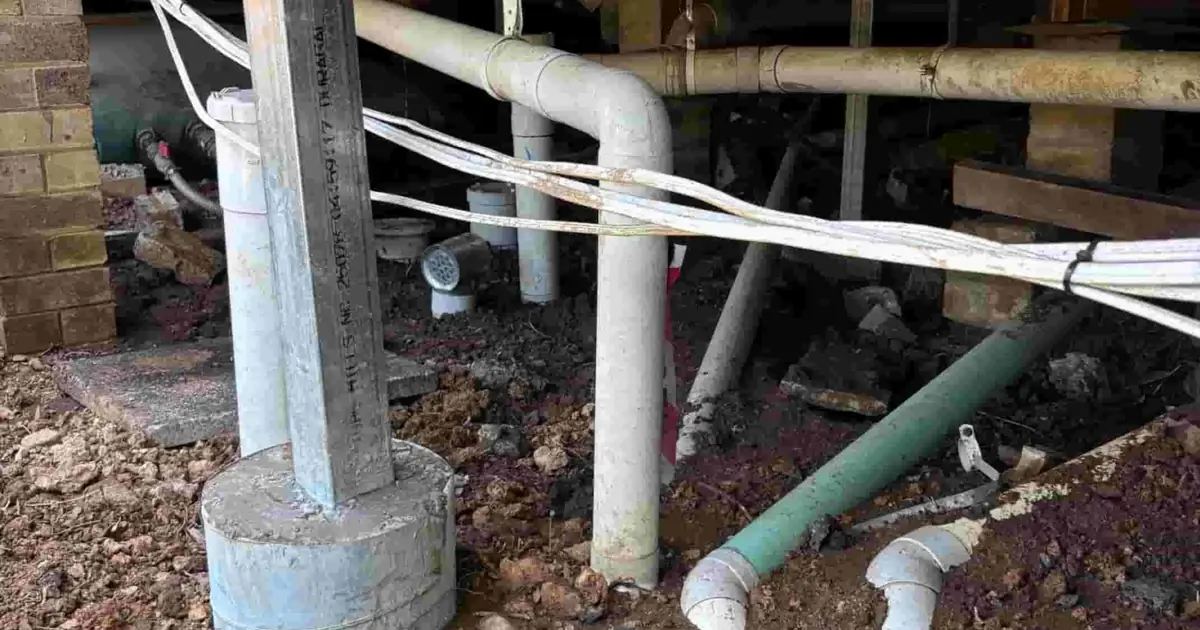
For a Northbridge property, SCE applies that experience to the route from the street to the work area, levels, drainage interfaces, temporary support and occupied areas. The nearby Lane Cove school project below demonstrates a coordinated sequence of investigation, excavation, structural repair and reinstatement.
SCE Corp's completed Lane Cove structural remedial project included temporary support, engineered footing and steel work, damaged sewer-line replacement and reinstatement at the school. The sequence was coordinated around the school-holiday programme.
This Lane Cove project demonstrates how structural repairs, drainage and reinstatement can interact within one construction programme. For a Northbridge property, investigation and measured access determine the appropriate method and price.
Practical answers about access, adjoining property and the responsibilities involved in constrained-site construction.
Provide the exact address, asset type and work area; photographs and available drawings or reports; known level changes; driveway, stair, lift or side-access dimensions; parking and delivery limits; occupied areas; adjoining-property interfaces; urgency; and the people authorised to make decisions.
No. Northbridge includes varied properties and conditions. The exact site should be checked using the available survey, inspection evidence, drainage information, structural records and professional input appropriate to the work before a cause or permanent response is selected.
Map the complete route from the legal loading point to the workface. Check vehicle and equipment dimensions, grades, headroom, turning, lift or stair capacity, temporary support, storage, waste removal, pedestrian separation and the condition required when the route is handed back.
Record the agreed boundary and access rights, current condition of relevant adjoining assets, protection measures, traffic and pedestrian controls, working periods, noise or vibration limits, contact and escalation arrangements, inspection hold points and any change from the authorised plan.
The required engineer, designer, certifier, registered practitioner and approval roles depend on the exact work. SCE Corp coordinates construction within the agreed scope, while appointed professionals retain their project-specific responsibilities. SCE is NSW DBP registered, not DBP certified or accredited.
SCE brings qualified engineering and construction experience in structural repairs, temporary works, drainage and staged reinstatement. The nearby Lane Cove school project illustrates that combined capability. Its photographs are labelled Lane Cove; a Northbridge project receives its own site investigation and delivery plan.
Share the work area, available records, access route, level changes, drainage or retaining interfaces, occupied areas and required timing. SCE will identify the investigations, engineering and construction sequence needed to develop your project.